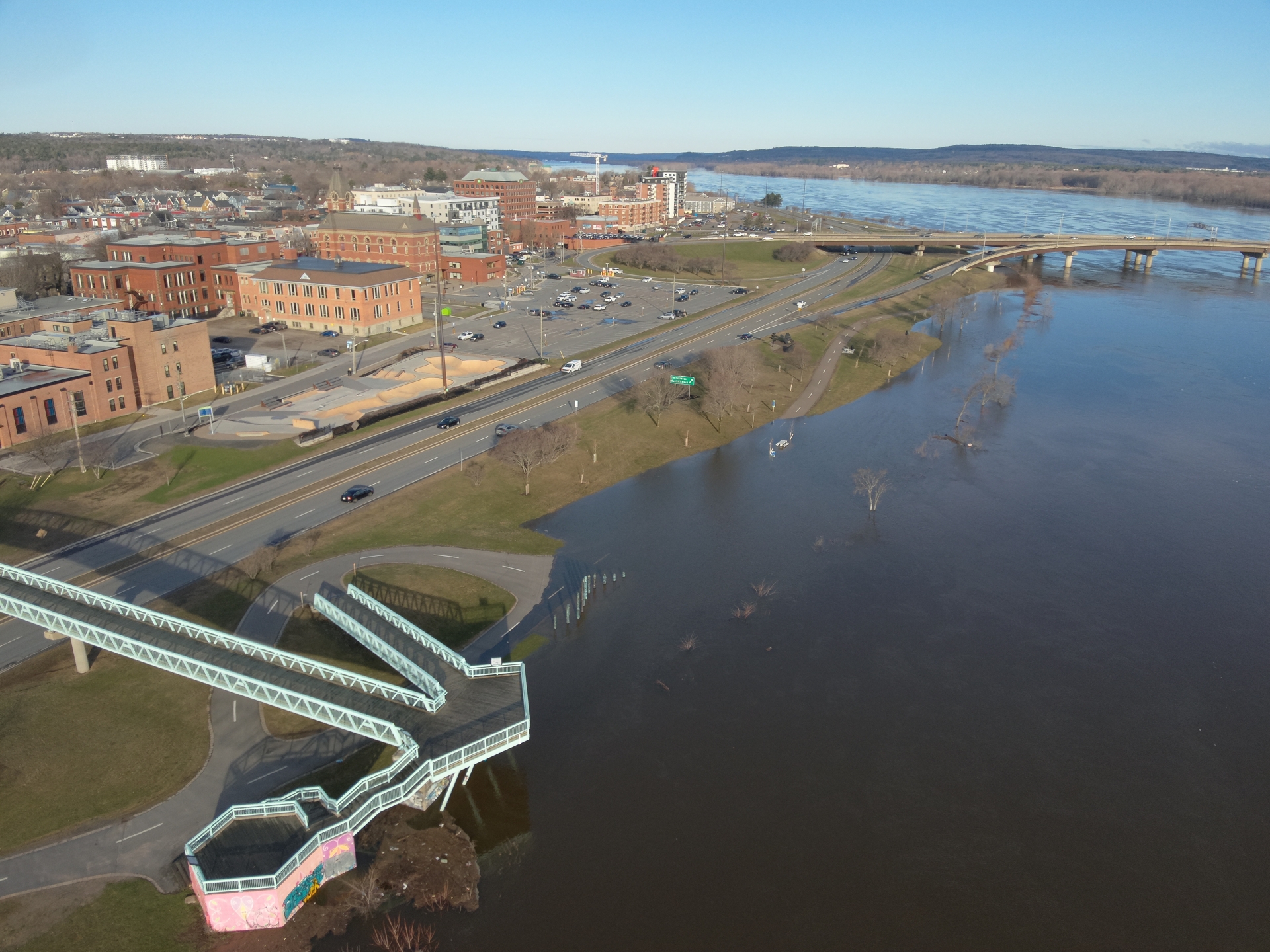
The City of Fredericton’s Emergency Measures Organization has activated to Level 1: Enhanced Monitoring, following an increase in levels in the Wolastoq (Saint John River).
River levels are currently at 6.2 metres, approximately 0.3 metres below flood stage, following a faster-than-forecast rise driven by weekend warmth and rainfall. Based on current conditions, the river is expected to reach flood stage by Tuesday, April 21, 2026, with peak levels forecast at approximately 6.6 metres. Flood stage begins at 6.5 metres.
The City of Fredericton is prepared, and our teams are trained and ready, actively monitoring conditions.
The following trails are currently closed:
- Morell Park
- South Riverfront Trail – Fredericton River Centre to Beaverbrook Art Gallery
- North Riverfront Trail – Picaroons to Hillcourt Drive
- Salamanca – Morell to Princess Margaret Bridge
- The Valley Trail to Hartt Island RV Resort
As water levels rise, the following areas may be affected:
- Bourque Lane
- Upper Queen Street Parking Lot
- Carleton Park Parking Lot
- McMinniman Court
Please be mindful that water levels are rising on several trails. Use caution near the water’s edge, floodwaters can produce currents and can carry debris.
The City will continue to monitor conditions and will share updates as more information becomes available.
Being proactive is key to protecting your home, property, and loved ones. Learn how to safeguard your space, what to do in an emergency, and whether your home is in a flood-prone area here.
Learn more about what to include in your 72-hour emergency kit.
Daily updates will be provided on the City of Fredericton website, Facebook, Instagram and Voyent.